NSERC CRD DROUGHT PROJECT
![]()
![]()
![]()
![]()
![]()
![]()
![]()
![]()
![]()
Background and Rationale for Study (see photos below of biological proxies used)
Projecting future water availability is one of the main challenges of water management. Given the difficulty of this task, one of the first steps is to better understand what extremes are possible, and the probability and spatial extent of these extremes. This knowledge is essential to develop a framework to manage water resources, since knowing the extremes in past water availability allows a clearer view of possible future conditions. Given the enormous size of the Winnipeg River Drainage Basin (WRDB), changes in one region may not be representative of changes in another region. In our research project we will develop and apply techniques to assess the spatial and temporal variability in water availability in the southern and northern watersheds of the WRDB. This work will develop new approaches that were initially investigated in conjunction with Manitoba Hydro from 2003-2007 as part of Cumming's Premier's Research Excellence Award from the province of Ontario. As part of this award, we developed an approach based on analysis of several indicators preserved in sediment cores that can be used to quantitatively determine declines in lake level (see Techniques for estimating past lake levels in drainage lakes below). This multi-proxy paleolimnological approach utilized the biological, chemical and physical signals preserved in lake sediments to reconstruct past lake conditions and infer conditions in the surrounding environment (Laird & Cumming 2008, Laird & Cumming 2009).
Analyses of sedimentary cores from lake basins can extend our view of climatic variability and extremes back in time. This extended view is extremely important for future management of water resources because numerous studies have indicated that the climate variability witnessed during the 20th century is not representative of the full range in extremes (e.g., St. George and Nielsen 2002, Laird et al. 2003, Cook et al. 2007, Laird and Cumming 2008). For example, in the Red River Valley of southern Manitoba, tree-ring analyses indicate that a century-long period of generally arid conditions prevailed from ~ AD 1670 to AD 1775 (St. George and Nielson 2002). Tree-ring analysis within the WRDB over the past 220 years indicates that summer droughts were more persistent during the 19th and 18th century, with the longest interval of warm, dry summers occurring in the 1880s and early 1890s (St. George et al. 2008). Our recent findings from the Experimental Lakes Area (ELA) (Laird and Cumming 2008, Laird and Cumming 2009) indicated that the period around the 1890s had some of the lowest lake levels of the past ~1500 years with average declines of 0.8 m, whereas before ~1500 years ago declines of > 2m were common (Laird and Cumming 2008). Recurrent drought also occurred during the 1880s and 1890s in the Great Plains of North America, other areas of the North American west, as well as other mid-latitudes around the globe, being linked by persistent La Niña-like sea surface temperatures (SSTs) in the tropical Pacific (Cook et al. 2007).
Our detailed lake-level analyses from ELA provide a starting point of understanding hydrological changes in the WRDB. Spatial variability in total annual precipitation during the 20th century is large in the WRDB (e.g., Fig. 1in CRD proposal), with correlations between the sites varying from 0.27 to 0.66 (Table 1 in CRD proposal). Decadal-scale periods of low precipitation also vary tremendously across the WRDB. For example, Kenora indicates low precipitation in the 1930s, 1950s and 1980s, whereas, Fort Frances has low precipitation in the 1920s and 1950s, and all sites indicate at least parts of the 1980s as having low precipitation (Fig. 1 in CRD proposal). Because of this inherent spatial variability in precipitation additional records of past conditions are required before a general picture of water availability across the basin can be drawn. Multiple records of past lake levels can help to detail the frequency and severity of past extremes on a spatial basis, thereby providing a regional picture of hydrological variability that would be of interest to long-range water planners at Manitoba Hydro.
Increases in mean annual temperature of 0.5-0.6 ºC have occurred since the 1900s across much of Ontario (Smith et al. 1998). Data from Kenora, in northwestern Ontario indicates that there has been a highly significant increase of ~1.2 ºC since 1900 (Fig. 2 in CRD proposal). Projected increases in mean annual temperatures in Ontario from Global Circulation Models (GCMs) suggest an average increase of 1ºC to 2ºC (IPCC 2007). Evaluating province-wide long-term trends in precipitation is more difficult than temperature due to the inherently high spatial variability and the difficulties associated with accurately measuring precipitation (IPCC 2007). Although many regions of Canada are projected to have increased precipitation under increasing atmospheric CO2 concentrations, there is great uncertainty in both the temporal and spatial distribution of future precipitation based on GCMs (Schindler 1997, Hofmann et al. 1998, IPCC 2007). A series of carefully developed paleolimnological records can provide empirical data on past water levels and as a consequence provide a realistic range of variation in water availability. This data is essential to determine if the last 100 years and specifically the drought in the 1930s is the appropriate gauge for planning for future extremes.
The purpose of this research is to select key sites within the WRDB from which analyses of lake sediments, along with the further development of our multi-proxy techniques, can provide a picture of long-term patterns in lake levels. The WRDB is a pivotal region of focus because it is adjacent to the semi-arid Great Plains, which is considered a transitional region between the humid east and arid west (Cook et al. 2007). Because of this geographical closeness, at least parts of the WRDB have often been synchronous with arid periods of the west (e.g., 1880s-1890s, 1930s, 1980s) and thus is a key region of the more typically humid east to determine the long-term susceptibility to drought. Analysis of these records will allow the assessment of the degree of spatial and temporal variability of water availability within the WRDB basin, thereby putting the 20th century variability within a long-term context.
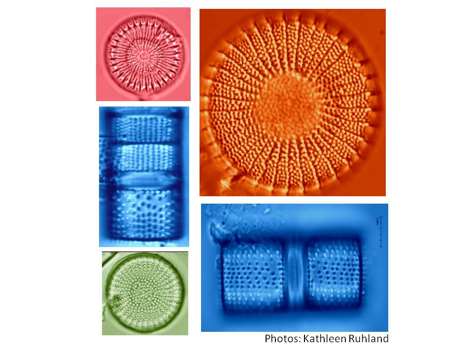
Photos of biological proxies used in this study: Left panel: diatom; Right panel: chrysophyte scales.
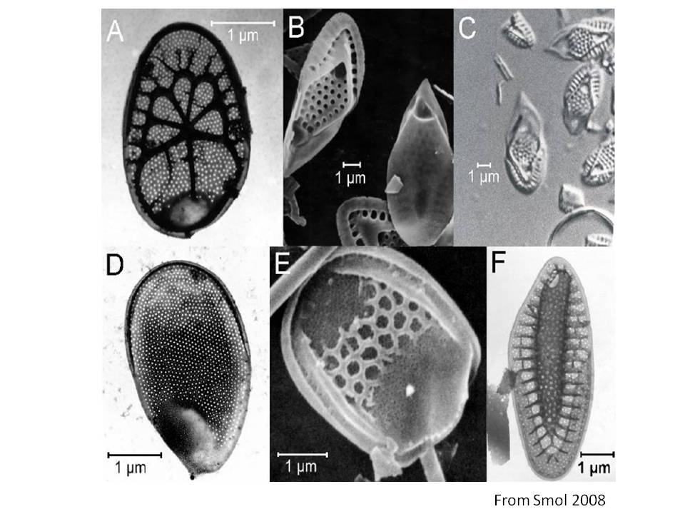
Techniques for estimating past lake levels in drainage lakes: The strongest evidence of past changes in lake level in small drainage lakes can be preserved in near-shore sediment cores (Dearing 1997, Battarbee 2000) through a technique similar to the Digerfeldt method. The Digerfeldt method is a technique used to track sedimentary units across a transect of cores sampled from the shore towards the center of the lake (Digerfeldt 1986). Our analyses are based primarily on the algal (plant) remains of diatoms and scaled chrysophytes. Diatoms are single-celled plants that preserve well in lake sediments because of their siliceous cell walls, and are very sensitive indicators of chemical and physical changes in lake conditions (e.g, Smol 2008). Some chrysophyte species have siliceous scales that are preserved in lake sediments and high abundances of scales relative to diatoms are indicative of increases in lake depth due to the preference of scaled chrysophytes for open-water habitats. Because material preserved in the sediment cores can be dated through various methods (e.g., 210Pb and 14C analyses), the analysis of lake sediment cores can provide a view into the past (e.g, Smol 2008).
We use a multiple indicator approach to infer lake level, with our primary analysesbased on the diatom assemblages preserved in the sediment cores, along with values of the proportion of chrysophyte scales to diatoms, and estimates of organic matter (OM) content.A quantitative model to infer lake level was developed from ELA Lake 239 from the analysis of the diatom assemblages in surficial sediments (Fig. 4 in CRD proposal) along a depth gradient from near-shore littoral communities to deeper planktonic diatom communities (e.g., Fig. 5a in CRD proposal, Moos et al. 2005). This method of determining the relationship of diatoms to depth within the study lake has often been proven to provide stronger predictive models for depth reconstruction than analysis of the distribution of diatoms across a suite of lakes along a depth gradient (e.g., Laird and Cumming 2008). For Lake 239, the diatom-inferred depth model provides a very good estimate of observed depth below a depth of ~ 13m (Fig. 5b in CRD proposal). This model was used to infer changes in lake level through time from the diatom assemblages preserved in near-shore cores taken at a current depth of ~13 m. The sediment core retrieved from ~13m was selected for detailed analysis due to its proximity to the ecotonal variations that are present in the surficial samples from 13m and shallower (Fig. 5a in CRD proposal). This technique is excellent at quantitatively estimating declines in lake level, but may not accurately detect large increases in lake level based on this core alone. However, analysis of a series of near-shore cores can enable a quantitative estimate of both lake-level lows and highs (Laird & Cumming 2009). The proportion of chrysophyte scales to diatoms can be used as a qualitative indicator of the boundary between the littoral (shallow near-shore) and pelagic (deeper central) lake zones (Fig. 5a in CRD proposal). In addition, changes in percent organic matter (OM) content in sediments can be used to indicate changes in the boundary between the littoral and pelagic zone (Fig. 5c in CRD proposal). Large changes in OM occur at the boundary of the near-shore littoral zone (Shuman 2003) and analysis of OM in lake sediment cores can provide a means of tracking past changes in the sediment limit or depositional boundary depth (i.e., the lower edge of the littoral zone) as it moves toward the center of the lake during declines in lake level (Dearing 1997).
Lakes which tend to preserve Digerfeldt’s lines of evidence for lake-level change have been described as typically being small (< 50 ha), relatively shallow (< 10 m max depth) and have a catchment area to lake area ratio of < 5:1 (Dearing 1997). However, slightly larger lakes are also appropriate, especially if indicators such as diatoms and scaled chrysophytes are used. Lake 239 is ~56 ha and has a catchment to lake area ratio of 4.3. However, its maximum depth falls much outside of the typical ‘Digerfeldt lake’ at ~ 32 m. This suggests, that at least in the case of Lake 239, it is the clearly defined sedimentation limits, which we base on our analysis of OM and diatoms in surface samples along a depth transect, and the location of our near-shore cores along a relatively shallow underwater slope that proved successful. The location of these near-shore cores was critical to our study and was based on prior knowledge of sediment deposition provided by high-resolution acoustic (echo sounding) data profiles provided by Mike Lewis from the Geological Survey of Canada (see Study Lakes for further detail), in collaboration with personnel from the Manitoba Geological Survey. The acoustic profiles enabled us to choose an area that had the greatest near-shore sediment deposition with relatively gentle slopes. In addition, direct groundwater flow to Lake 239 is negligible (Schindler et al. 1996) and thus groundwater interactions likely did not complicate the lake-level reconstructions (e.g., Digerfeldt et al. 1992). We will continue to refine and develop both the quantitative inferences and the collaborating qualitative techniques for estimating lake-level changes in drainage basins using a variety of approaches. Our goals for further development include: 1) refining of the depth models; 2) develop methods that minimize the time of analysis; and 3) explore other proxy indicators preserved in the lake sediments.
References Cited:
Battarbee RW (2000) Quaternary Science Reviews 19: 107-124.
Cook ER, Seager R, Cane MA, Stahle DW (2007) Earth-Science Reviews 81: 93-134.
Dearing JA (1997) Journal of Paleolimnology 18: 1-14.
Digerfeldt G. (1986) Studies on past lake-level fluctuations. In Berglund BE (ed), Handbook of Holocene
Palaeoecology and Palaeohydrology. John Wiley, Chichester, 127-143.
Digerfeldt, G., Almendinger, J.E., Björck, S., 1992. Palaeogeography, Palaeoclimatology, Palaeoecology
94, 99-118.
Hofmann N, Mortsch L, Donner S, et al. (1998) Climate change and variability: impacts on Canadian
water. In Koshida G, Avis W (eds) Responding to Global Climate Change: National Sectoral Issues,
Vol. VII The Canada Country Study: Climate Impacts and Adaptation. Environment Canada, Ottawa.
IPCC (2007). Summary for Policy Makers. In: Solomon S, Qin D, Manning M, et al. (Eds.) Climate
Change 2007: The Physical Science Basis. Contribution of Working Group I to the Fourth Assessment
Report of the Intergovernmental Panel on Climate Change. Cambridge University Press, Cambridge,
United Kingdom and New York, New York, USA.
Laird KR, Cumming BF, Wunsam S, Rusak JA, Oglesby RJ, Fritz SC, Leavitt PR (2003) Proceedings of
National Academy of Sciences 100: 2483-2488.
Laird KR, Cumming BF (2008). Reconstruction of Holocene lake level from diatoms, chrysophytes and
organic matter in a drainage lake from the Experimental Lakes Area (northwestern Ontario, Canada).
Quaternary Research 69:292-305.
Laird KR, Cumming BF (2009). Diatom-inferred lake level from near-shore cores in a drainage lake from
the Experimental Lakes Area, northwestern Ontario, Canada Journal of Paleolimnology in press DOI:
10.1007/s10933-00809248-9
Moos MT, Laird KR, Cumming BF (2005) Journal of Paleolimnology 34: 217-227.
Schindler DW (1997) Hydrological Processes 11: 1043-1067.
Schindler DW, Baylet SE, Parker BR, et al. (1996). Limnology and Oceanography 41: 1004-1017.
Shuman B (2003) Journal of Paleolimnology 30: 371-385.
Smith J, Lavender B, Auld H, Broadhurst D, Bullock T (1998) Adapting to climate variability and change
in Ontario. Vol. IV of the Canada Country Study: climate impacts and adaptation. Environment
Canada, Ottawa.
Smol JP (2008) Pollution of Lakes and Rivers: A Paleoenvironmental Perspective- 2nd edition. Blackwell
Publishing, Oxford.
St. George S, Nielsen E (2002) Quaternary Research 58: 103-111.
St. George S, Meko DM, Evans MN (2008). Quaternary Research 70: 158-192.