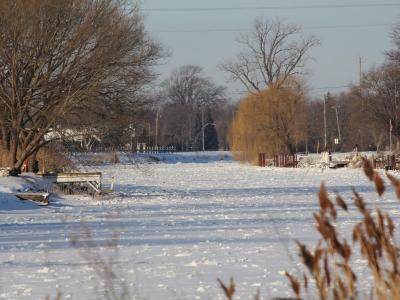
This stretch of Sydenham river acted as a main travel route to Indigenous communities, courtesy of Rick Fehr.
Our historical ecology research intends to resurface Indigenous and settler historical land use practices in an attempt to redress colonization of Indigenous peoples and past practices that fundamentally altered the biodiverse habitats of Southern Ontario.
Novel approaches to sustainable planning in the 21st century requires comprehensive insight into the past. By considering the historical ecology of municipalities such as Chatham-Kent, we are reconsidering what traditional territory means. For many people who live in the municipality, either in a rural area or one of the dozens of communities within its borders, there is minimal understanding of Indigenous presence on the territory. Yet, for the Anishinaabeg population of Walpole Island, Chatham-Kent forms a significant part of their traditional territory. Their ancestors were born there, they also lived, farmed, hunted, trapped, formed communities, and were buried there. It is still very much a part of their home.
Anishinaabeg experience on the land and waters of the traditional territory reveals extensive and diverse approaches to agriculture, hunting, fishing, trapping, and permaculture. Each of these modes of living required concerted effort to shape and reshape the land to suit the community’s purposes. One of the key questions this raises is how might these ways of living be reconsidered for sustainable approaches to planning in the 21st century? While this question is relevant for all citizens, it is more so for the Indigenous population as it reasserts its presence across the traditional territory.
This research simultaneously asks us to consider the ways the land and water has been shaped and reshaped by successive generations of settler experience.
While extensive records of land changes exist, there is greater difficulty tracking the histories of Indigenous land use. Generations of colonization ensured that only the stories of settlers were told. This research draws from centuries-old journals, land survey records, and Anishinaabeg and settler oral stories when they were recorded. The result is a surprisingly vibrant landscape filled with Indigenous presence, where land and water was considered under a different value system.
The project uses the following methods:
- archival research
- GIS Mapping
- interviews
- digital storytelling
This research is led Dr. Rick Fehr and Janet Macbeth.