A climate change disaster
Did you know that Herstmonceux Castle’s history and indeed its entire raison d’etre is linked to a climate change disaster?
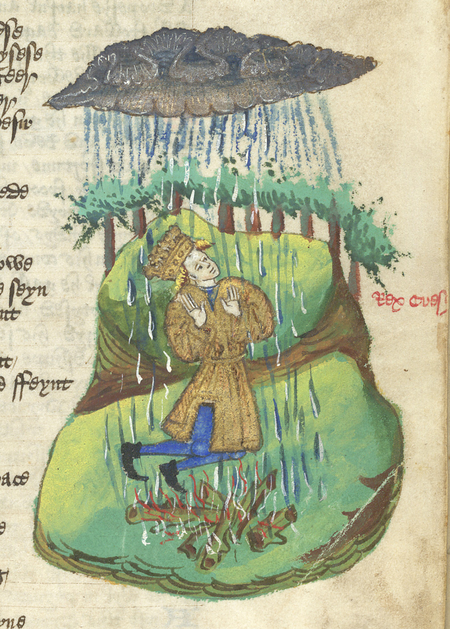
 We know that Herstmonceux was farmed from Anglo-Saxon times, throughout the Norman Conquest and until around the late 1300s. Records show that after the year 1250, global temperatures cooled dramatically due to an expansion of north Atlantic ice around the same time. For decades East Sussex was hammered with the most torrential rains and storms that battered the land, causing terrible floods. In 1341 for example, nearby Hooe lost 400 acres of farmland and in 1375 the whole of Herstmonceux was completely waterlogged, leading to grain shortages and famine. Scientists estimate that in total, the county of Sussex lost over 10,000 acres of arable land to the flooding.
For the peasants struggling to work the remaining land in Herstmonceux, the decision to build the Castle in 1440 provided opportunities for work and an alternative livelihood. When Sir Roger Fiennes received permission from the crown to crenellate his manor, there was further good news when it simultaneously expanded the estate of Herstmonceux to 600 acres by royal decree. A massive enclosed, private deer park was created, providing a life-saving boost to the local economy, and essentially turning Herstmonceux Castle into a resort destination for the rich and famous of the day.
Environments of Change is an interdisciplinary research collaboration that uses Herstmonceux Castle and the surrounding area as a focus for some truly remarkable research. Cutting-edge technology, such as digital mapping and 3D modelling is being used to research how factors such as historical weather patterns, climate change, and access to water have shaped how humans lived.
Virtual archaeology is sure to play a major role in the future research plans and examples of what can be achieved can be seen here with this 3D model of the Castle:
Attracting interest
We sincerely hope the rest of the Castle community is as flattered as we are that our little corner of East Sussex is garnering such scholarly (and international) interest! It is hoped that the research carried out by Environments of Change will not only provide a better understanding of the history of Herstmonceux, but ultimately provide agencies with vital information concerning the history of climate change in Europe that can influence policy makers in the UK and EU.
Visit the environments of change website
Bader College's Science Coordinator Dr Simon Coppard, recently worked with two Master’s students (Erin Kurian and Jacqueline Gergal, from our long-time research partners, the University of Waterloo) to produce short videos on The Medieval Climate Optimum and the Little Ice Age from a global and a local southeast UK perspective. These will form the start of a display explaining the Environments of Change project to the general public.
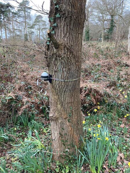
 Simon has also been putting up dendrometers on oak trees on the estate to measure tree growth in relation to precipitation and microhabitats and taking tree cores of the oldest oak trees to measure oxygen isotope ratios in the tree rings. In collaboration with Professor Neil Loader at Swansea University, we will use the isotope ratios to reconstruct summer temperatures and summer precipitation at the Castle through time, ideally back to the Medieval Climate Optimum. With the help of Bader College students, Simon hopes to extend this to other old oak trees in the area, so students will help with the tree coring (which is sterile and does not harm the tree) and data analysis.
The plan is also to begin taking exploratory sediment cores across the Pevensey Levels, particularly from around the edge of the valley where rivers run into the valley near Wartling and from behind the Pevensey sea barrier. Such ‘washovers’ at the barrier may provide information on sequential breaching events through time and, therefore, information on flooding. One of the questions we are interested in is whether the Pevensey Barrier is more recent than the barrier at Romney Marsh, and if so, why? Students will help with core sampling and identifying diatoms through the core stratigraphy (freshwater species versus marine) and help look for areas of sand above and decomposed vegetation to indicate more recent fluvial action. We hope to use isotope analysis of decomposed vegetation to date these events and establish what is natural and what constitutes medieval activity.